Second Anglo Boer War (1899 – 1902): Town Guards/Forts of Uniondale & Boer Invasion
SECOND ANGLO BOER WAR (1899 – 1902): TOWN GUARDS/FORTS OF UNIONDALE & BOER INVASION
Compiled by Wolfgang Witschas

Introduction
Uniondale is a small town in the Little Karoo and lies adjacent to the Langkloof, which winds its way through the foothills of the of the Tsitsikamma Mountain range. The town was formed in 1856 by the joining of two towns, Hopedale and Lyons. When Uniondale was founded, it was part of the Cape Colony under British rule. During the Second Anglo Boer War in 1901, Boer invasion. Of the southern part of the Cape Colony, a “Town Guards” was founded.
History
It is clear that the town of Uniondale felt confident that they were far removed from the war zone, even after receiving news that the Boer commandos had entered the Cape Colony and were percolating down to the west and towards the coastal plain. The British military authorities were in remiss not advising towns like Uniondale and nearby Willowmore to look to their defences.
First Boer invasion of Uniondale
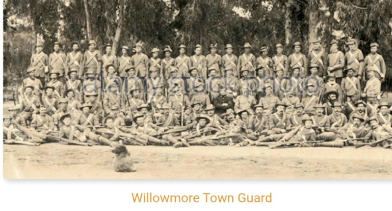
Commandant Gideon Jacobus Scheepers and his commando attacked Willowmore on 19 January 1901, following the second Boer incursion into the Cape Colony, but the town guard of 320 white and coloured men put up stiff resistance. As a result Scheepers decided to move to Uniondale more speedily than he would have if he had taken Willowmore and being delayed by the usual looting. For Uniondale it was too late to make the necessary preparations to repel the commando and those with transport left the town during the night of the 19th or the next morning, those who remained stood around exchanging views, and the coloured people sat silently in their small houses anticipating the worst.
The Boer “outposts” (scouts) were reported in the surrounding hills at 11:00 on 20 January 1901 and the Scheepers commando of about 50 men rode into Uniondale around mid-day. The telegraph operator send out a quick message to his head office announcing the arrival of the Boers, and then left taking his equipment with him. The commando was met by the resident Magistrate as it rode into town demanded and received the keys for the Court House and jail. The Boer then seized all the useable horses. A Hussars unit that protected the town, were out on patrol some 40 km’s away, were returning. Scheepers and his commando hastily saddled up and left Uniondale.
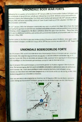
The 10th Hussars, mounted infantry under the command of Lieutenant Colonel WH Williams, entered the town just before 10:00. The immediate task was to bring the town back to normality. Next a “Town Commandant”, Captain R Dippenaar, was appointed and a “Town Guard” was established and speedily rendering the town into a “fortress”. Captain Dippenaar ordered the construction of defensive posts or what he called forts around the periphery of the town on high lying ground. Five small forts were built on the hills around the town which served as observation points to protect the town (four according to some accounts, and Five according to others), four of which are still visible. The forts served as defensive stronghold, providing strategic vantage points over the surrounding landscape. The best-known fort is situated directly above the town in the Uniondale Nature Reserve and was restored by the author Dalene Matthee during her seven-year stay in Uniondale.
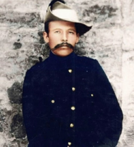
Gideon Jacobus Scheepers
Description and Features of the Forts
The forts were constructed with specific design and material reflecting their purpose during the war.
• Four main Forts were identified with some sources reflecting a total of five or six
• The forts had a typical circular to oval shape with walls made of local stone and mud mortar
• Features included covered entrances, vertical walls with a pronounced batter and widely-splayed loopholes for defence
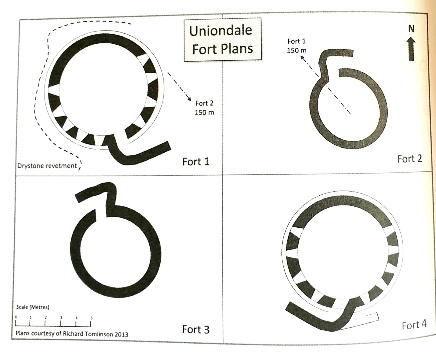
• Fort 1 is the largest, measuring 6.2/6.7 meters in diameter, while Fort 2 is the smallest at 3.0/3.5 meters
Detailed Analysis of each Fort
Each fort has unique characteristics and varying states of preservation, impacting their historical significance
• Fort 1: Is the largest fort restored in 1976, with a diameter of 6.2/6.7 meters in diameters, entrance face away from the town
• Fort 2: Is the smallest fort measuring 3.0/3.5 meters, walls have largely collapsed but it commands a strategic view
• Fort 3: Constructed from shale, filled with rubble, measures 4.0/4.2 meters internally with significant deterioration
• Fort 4: Best preserved fort, made of yellow-red sandstone measuring 4.6/5.0 meters features several surviving loopholes
Wikimedia Commons is a non-profit,
free-content Wikimedia Encyclopaedia
Fort 1:
Wikimedia Commons is a non-profit,
free-content Wikimedia Encyclopaedia
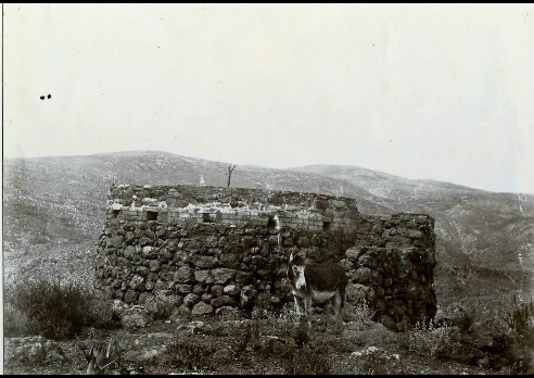
Fort 2: photograph taken in the 1950s
Wikimedia Commons is a non-profit,
free-content Wikimedia Encyclopaedia
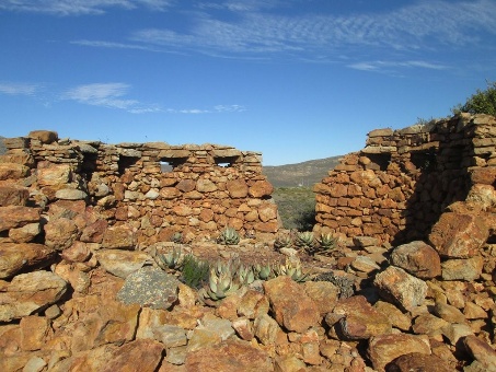
Fort 3:
Wikimedia Commons is a non-profit,
free-content Wikimedia Encyclopaedia
Fort 4
Wikimedia Commons is a non-profit
free-content Wikimedia Encyclopaedia
The forts, although the term “fort” might be somewhat misleading, as these structures were simple fortified observation points and also serve as reminders of the strategic military operations that took place in the region during the Second Anglo Boer War.
The forts were simple stone structures with a basic design, reflecting their purpose as fortified observation points.
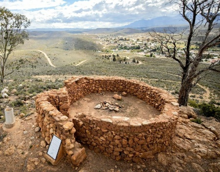
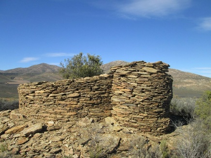
The forts’ design features an entrance layout that prevents a direct view of the interior, which would have enhanced the defensive capabilities of the structure. This clever design element would have made it more difficult for potential attackers to immediately assess the interior or target occupants upon entry. The design reflects the practical considerations and security concerns of the time, showcasing the resourcefulness of those who built these simple yet effective structures (see photo 1)
Constructed primarily from local good quality red-yellow sandstone, with the usual mud dagha for motar. The fort measures 46/5.0 metres across internally. The walls stand to a maximum outside height of 2.8 metres towards the town and 2 metres inside; they are 800mm thick at the base. The unique designed entrance passage is 3.5 meters long and 1 metre wide. The entrance faces away from the town, this may be because the attacks were to be expected from the direction of the town (north west), but most likely because the entrance to the south east covered by fort number 2 on the same kopje.
These forts were designed to withstand attacks while serving as shelters for soldiers stationed there. Although no proof or records exist that the forts had any kind of roofs, it can be assumed that most probably canvas was used for roofing as a temporary or makeshift design to provide shelter against the elements.
Key features of the Forts’ design and layout:
• Design
All forts were built to approximate similar design with the following features:
Roughly circular to slightly oval in plan.
A covered entrance 600-700cm wide, protected by a concentric screen wall built outside the entrance to form a narrow access entrance, the same width as the entrance (a design which was termed “snail shell”)
• Stone Construction:
The forts were built using local stone, which provided a degree of protection against small arms fire
• Small Size:
The forts were relatively small, indicating they were not intended for large-scale battles or prolonged sieges
• Loop holed Walls:
The forts featured loop holed walls, allowing defenders to fire rifles while remaining relatively safe from enemy fire
• Entrance
The entrance was designed in such a way to to protect the interior from direct fire and forts covered each other’s entrance
• Roofing:
The forts possibly had canvas roofs, which provided some protection from the elements but would not have offered significant protection against artillery or
other forms of attack
The design and layout of the Uniondale forts reflect their purpose as observation points and defensive positions, rather than as heavily fortified strongholds
Today, the forts stand as significant historical landmark, offering visitors a glimpse into South Africa’s wartime past while enjoying the natural surroundings of Uniondale.
Wikimedia Commons is a non-profit
free-content Wikimedia Encyclopaedia
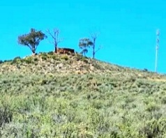
Fort 1: See strategic position
on top of hill
Wikimedia Commons is a non-profit,
free-content Wikimedia Encyclopaedia
Second Boer invasion of Willowmore & Uniondale/Gideon Scheepers “Last Battle”
The second Boer invasion into the Cape Colony a few months later in August 1901 was far more intense and resulted in a number of deaths on both sides. There after a number of serious skirmishes took place around the district involving as many as 400 Boers and 350 British soldiers.
At 04:00 on 01 June 1901 Scheepers again attacked Wllowmore, which was defended by a garrison of 263 men. Willowmore probably, because of its successful defence of the town in January 1901 does not seem to have followed Uniondale’s example in building a series of stone forts in the surrounding hills. So when Scheepers arrived again the Commandant, Captain R Diespecker, had to content himself with forming a series of defensive posts around the peripheries of the town, the nature of these posts is not explained. From these posts another stout defence was mounted with the outer posts manned by the Native Contingent, sustaining the most casualties. By 11:00 firering had ceased and Scheepers’ commando broke away towards Aberdeen. Scheepers had probably heard that Uniondale was now defended by forts and decided not to go that way this time.
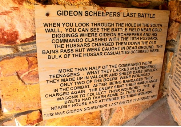
There were Boer engagements near Uniondale in August 1901, but the main action was nearer to Avontuur, on the old Thomas Bain Pass over the Witberg or Zondagh-se-Berg, which at that time linked Avontuur. Here the Scheepers commando clashed with the 10th Hussars on 18 August 1901 and the Hussars being badly mauled.
This skirmish took place on 18 August 1901 when the commando of Gideon Scheepers, about 270 strong which had been travelling west along the Langkloof, was engaged by the British 10th Hussars who had crossed the hills from Uniondale to intercept them.
In the action which followed the commando split into three sub-units and caught the hussars in dead ground, inflicting several casualties and suffering two wounded itself.
Scheepers had his last skirmish before being taken prisoner after he became ill during late September 1901 and eventually on 10 October 1901 had to be left behind. He was taken prisoner on 12 October 1901.
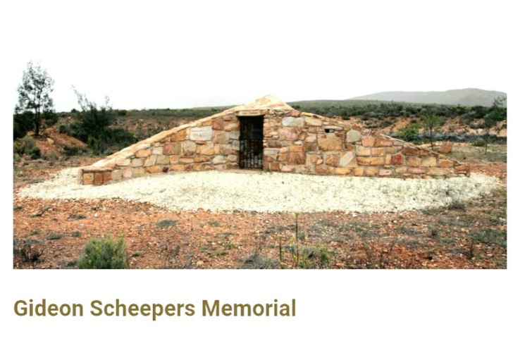
The Gideon Scheepers Memorial near the town of Uniondale:
The Gideon Scheepers Memorial in Uniondale commemorates the last battle of Gideon Scheepers, a Boer commandant, which took place on 19 August 1901. The memorial is situated on the corner of the De Hoop turnoff on the R339 between the R62 and Uniondale.
The memorial to what is rather grandiloquently termed “Gideon Scheepers Last Battle”.
Gideon Scheepers Memorial in Uniondale
Wikimedia Commons is a non-profit
free-content Wikimedia Encyclopaedia
Wikimedia Commons is a non-profit,
free-content Wikimedia Encyclopaedia
From inside the memorial, looking through the hole in the South wall on can see the site of the engagement.
References:
https://www.west2wildcoast.co.za/listing/uniondale-fort
https://www.uniondale.co.za/listing/boer-war-forts_6_2017
Report by Richard Tomlinson on the forts of Uniondale: 29/09/2013